2017–18 Grants
Following are summaries of the research grants award to date:
Developing a database for CVC investments in Japan
Ulrike Schaede, professor, GPS; Masato Sasaki, professor, Hitotsubashi University
In examining global corporate venture capital (CVC) activities by large Japanese companies, Ulrike Schaede and Masato Sasaki are going beyond the known numbers that — in contrast to approximately 20 percent in the U.S. — CVC accounts for 60 percent of investments in Japan. As such, they have built a database comprising CVC investments by Japanese companies outside Japan accessing the database CB Insights and, for those same companies within Japan, accessing the database Entrepedia. The data include approximately 5,000 deals in 3,000 startup companies globally with Japanese investments, covering more than 70 percent of total Japanese CVC activity in dollar terms. In merging these startup data with accounting data for the large investor companies, Schaede and Sasaki intend to assess the relevance of CVC investments on their business.
Proving the effectiveness of mapping with machine learning
Ran Goldblatt, postdoctoral researcher, GPS; Gordon Hanson, acting dean, GPS
With efficiency and affordability top of mind, Ran Goldblatt and Gordon Hanson are developing a novel machine-learning approach to map urban areas at large scales. Their methodology combines data from nighttime lights and Landsat 8 imagery for pixel-based image classification of built-up areas, using a transfer-learning approach that overcomes the lack of extensive ground-truth data. Tangibly, Goldblatt and Hanson have developed high-quality 30m resolution maps that characterize urban built-up land cover areas in India, Mexico and the U.S. This project is in collaboration with Columbia University, Arizona State University and Google Earth Engine.
Viewing land cover and land use in Vietnam
Ran Goldblatt, postdoctoral researcher, GPS; Gordon Hanson, acting dean, GPS
The majority of studies that analyze urbanization have been limited in part by the availability of extensive high-resolution satellite data, lack of ground-truth data and computational constraints — until now. Honing in on Vietnam by use of Google Earth Engine, Ran Goldblatt and Gordon Hanson have produced high-resolution, high-quality maps of built-up land cover and land use for the country. In doing so, they have demonstrated the applicability of their approach both to map annual changes in the extent of the built-up areas and to differentiate between residential and nonresidential land use. The methodology and the results of this study, Goldblatt and Hanson presume, will help governments and decision-makers answer questions related to policy, planning and distribution of resources. This project is supported in part by the World Bank.
Comparing city structures and functionalities
Ran Goldblatt, postdoctoral researcher, GPS; Sam Roy, Ph.D. candidate, Indiana University; Nick Clinton, lead developer advocate, Google Earth Engine
Urban areas house more than 53 percent of the human population, and the morphology of cities or their spatial structure (i.e., the street network or building structure) is intimately related to functionality. But to what extent? Ran Goldblatt, Sam Roy and Nick Clinton are turning to high-resolution satellite imagery to find out. Utilizing new nano satellites, such as SandBox, the researchers capture and generate data at high-spatial resolution and at high-temporal frequency. All the while, a high-resolution “spectral unmixing” image classification approach allows them to examine the morphology of cities locally and contextually. By applying these image classification methods, one can detect and map urban areas without relying on supervised machine-learning approaches that require expensive ground-truth data sets.
A crowdsourced understanding of the human footprint
Ran Goldblatt, postdoctoral researcher, GPS; Gordon Hanson, acting dean, GPS
Ran Goldblatt and Gordon Hanson are calling on “the crowd” for assistance with this project. Via crowdsourcing, they intend to collect more than 300,000 images tagged as “built-up” or as “not built-up,” based on human inspection. Using this first-of-its-kind data set to train a machine-learning algorithm to create a global map of urban activity at the finest level of spatial detail ever achieved, Goldblatt and Hanson will update these maps annually and make them available to the public free of charge, via Google Earth Engine. Their aim in measuring urbanization with a high degree of geographic precision and in close to real time is to transform how public policy is designed, identify strategies achieving sustainable urban growth, and help to create a high-resolution database of all built-up areas on Earth. Ultimately, Goldblatt and Hanson are revolutionizing the understanding of the human footprint. This project is in collaboration with Columbia University, Arizona State University and Google Earth Engine.
Exploring economic activity at small geographies
Ran Goldblatt, postdoctoral researcher, GPS; Gordon Hanson, acting dean, GPS; Kilian Heilmann, Ph.D. candidate, UC San Diego Department of Economics; Yonatan Vaizman, Ph.D. candidate, UC San Diego Department of Electrical and Computer Engineering; Amit Khandelwal, professor, Columbia Business School
Earth-observation data offers a new and potentially groundbreaking way to track the spatial distribution of economic activity and how it changes over time. A traditional proxy for economic activity is the intensity of the emitted radiation during the night, referred to as nighttime lights (NTL). While NTL are adequate proxies for aggregate economic activity, they have limitations for analysis of urbanization. The limitations of NTL for measuring economic activity have led geographers, economists, computer scientists and, now, Ran Goldblatt, Gordon Hanson, Kilian Heilmann, Yonatan Vaizman and Amit Khandelwal to capture physical characteristics of land by incorporating daytime high-resolution satellite images in their development of remote-sensing image classification methodologies. In this study, the researchers are exploring the potential and the limitations of remotely-sensed data as a proxy for economic activity at small geographic units using a commune-level data set from Vietnam. They compare the performance of commonly used NTL data and higher-resolution Landsat imagery. This project is supported in part by the World Bank.
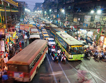 Eyeing how infrastructure affects urbanization in India
Ran Goldblatt, postdoctoral researcher, GPS; Gordon Hanson, acting dean, GPS
Developing countries are devoting massive resources on infrastructure, particularly intracity transport. However, standard approaches to trace impacts typically rely only on administrative data, which often are not available to the public, collected at infrequent intervals and/or have measurement challenges. High-resolution satellite data promises to improve understandings of how infrastructure, such as intracity transport investments, affect urbanization. And Ran Goldblatt and Gordon Hanson are using just this — publicly available satellite data — to map India’s land cover at a 30m resolution. Performing the analysis in Google Earth Engine, they aim to address how different types of transportation corridors affect the spatial distribution of activity within Indian cities; how city boundaries spread in response to infrastructure investments; how intercity size distributions change in response to intercity transport investments; and how spatial distribution of consumption and production change with infrastructure. This project is supported in part by the World Bank.